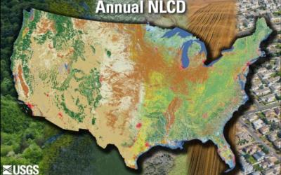
The following MRLC datasets are published as map services. These map services are available as Open Geospatial Consortium (OGC) Web Map Services (WMS). To utilize these services via your GIS application, copy the URL of your chosen service from the lists below (right click > copy link address).
Using the MRLC OGC Services
The following links provide tutorials on how to add the MRLC WMS layers to the QGIS and ArcMap clients.
- QGIS
- ArcMap
- ArcPro
- Annual NLCD Style Layer Guide (.pdf)
- Annual NLCD Fractional Impervious (.lyrx)
- Annual NLCD Impervious Descriptor (.lyrx)
- Annual NLCD Land Confidence (.lyrx)
- Annual NLCD Land Change (.lyrx)
- Annual NLCD Land Cover (.lyrx)
- Annual NLCD Spectral Change (.lyrx)
MRLC OGC Services
NLCD 2011 to 2016 ALASKA Land Cover Change Pixels
NLCD 2001 to 2016 ALASKA Land Cover Change Pixels
NLCD 2001 to 2011 ALASKA Land Cover Change Pixels
NLCD 2016 ALASKA Land Cover
NLCD 2011 ALASKA Land Cover
NLCD 2001 ALASKA Land Cover
NLCD 2001 HAWAII Land Cover
NLCD 2001 PUERTO RICO Land Cover
NLCD 2011 to 2016 ALASKA Impervious Change Pixels
NLCD 2001 to 2016 ALASKA Impervious Change Pixels
NLCD 2001 to 2011 ALASKA Impervious Change Pixels
NLCD 2016 ALASKA Impervious Surface
NLCD 2011 ALASKA Impervious Surface
NLCD 2001 ALASKA Impervious Surface
NLCD 2016 ALASKA Impervious Descriptor
NLCD 2011 ALASKA Impervious Descriptor
NLCD 2001 ALASKA Impervious Descriptor
NLCD 2016 ALASKA Urban Descriptor
NLCD 2011 ALASKA Urban Descriptor
NLCD 2001 ALASKA Urban Descriptor
NLCD 2001 HAWAII Impervious Surface
NLCD 2001 PUERTO RICO Impervious Surface
NLCD ALASKA Tree Canopy Change
NLCD HAWAII Tree Canopy Change
NLCD PUERTO RICO & U.S. VIRGIN ISLANDS Tree Canopy Change
NLCD CONUS Tree Canopy
NLCD 2016 ALASKA Tree Canopy
NLCD 2011 ALASKA Tree Canopy
NLCD 2016 HAWAII Tree Canopy
NLCD 2011 HAWAII Tree Canopy
NLCD 2016 PUERTO RICO & U.S. VIRGIN ISLANDS Tree Canopy
NLCD 2011 PUERTO RICO & U.S. VIRGIN ISLANDS Tree Canopy
RCMAP products can be found on RCMAP and EAG ArcGIS Online or by searching “RCMAP” in ArcPro software.
RCMAP Annual Herbaceous Cover
RCMAP Shrub Cover
RCMAP Litter Cover
RCMAP Sagebrush Cover
RCMAP Bare Ground Cover
RCMAP Herbaceous Cover
RCMAP Non-sagebrush Shrub Cover
RCMAP Perennial Herbaceous Cover
RCMAP Tree Cover
RCMAP Shrub Height Cover
RCMAP-Exotic Annual Grass products can be found on RCMAP and EAG ArcGIS Online or by searching “RCMAP Exotic Annual Grass” in ArcPro software.
Exotic Annual Grass 2026 Cheatgrass
Exotic Annual Grass 2026 Field Brome
Exotic Annual Grass 2026 Green Herbaceous
Exotic Annual Grass 2026 Medusahead
Exotic Annual Grass 2026 Sandberg's Bluegrass
Exotic Annual Grass 2026 Senesced Herbaceous
Exotic Annual Grass 2026 Total Herbaceous
Exotic Annual Grass 2026 Total Exotic Annual Grass